前言:
Collection2 包括全部Landsat L1级别数据再生产,全球L2级别数据处理。提高了L1级数据几何定位精度,辐射精度以及L2级产品精度。
简介:
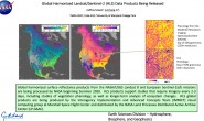
Landsat Collection 2 marks the second major reprocessing effort on the Landsat archive by the USGS that results in several data product improvements that harness recent advancements in data processing, algorithm development, and data access and distribution capabilities.
A primary characteristic of Collection 2 is the substantial improvement in the absolute geolocation accuracy of the global ground reference dataset – which improves interoperability of the Landsat archive through time. Collection 2 also includes updated global digital elevation modeling sources and calibration and validation updates.
Collection 2 includes Landsat Level-1 data for all sensors since 1972, as well as global Level-2 surface reflectance and surface temperature scene-based products from 1984 to present within defined constraints.
Collection 2 will become available in mid-2020.
Collection 1 based products, including: Landsat 8 OLI/TIRS and Landsat 7 ETM+ Collection 1 Level-1, U.S. Landsat ARD and Level-3 Science Products data processing and downloads will remain available for at least one year after Collection 2 is publicly released.
Landsat Collection 2标志着美国地质调查局(USGS)对Landsat档案进行的第二次重大再处理工作,该工作的结果是数据处理、算法开发以及数据访问和分发能力方面的最新进展,对数据产品进行了多项改进。
Collection 2的一个主要特点是大幅提高了全球地面参考数据集的绝对地理定位精度—-提高了Landsat档案的互操作性。Collection 2还包括更新的全球数字高程模型源以及校准和验证。
Collection 2包括1972年以来所有传感器的Landsat Level-1数据,以及1984年至今的全球Level-2级地表反射率和地表温度场景化产品。
Collection 2将在2020年中提供。
基于Collection 1的产品,包括: Landsat 8 OLI/TIRS和Landsat 7 ETM+集1 Level-1、美国Landsat ARD和Level-3科学产品的数据处理和下载将在Collection 2公开发布后至少一年内继续提供。
相关网页:
https://www.usgs.gov/land-resources/nli/landsat/landsat-collection-2?qt-science_support_page_related_con=1#qt-science_support_page_related_con
L1 更新关注点
1 几何定位精度提高
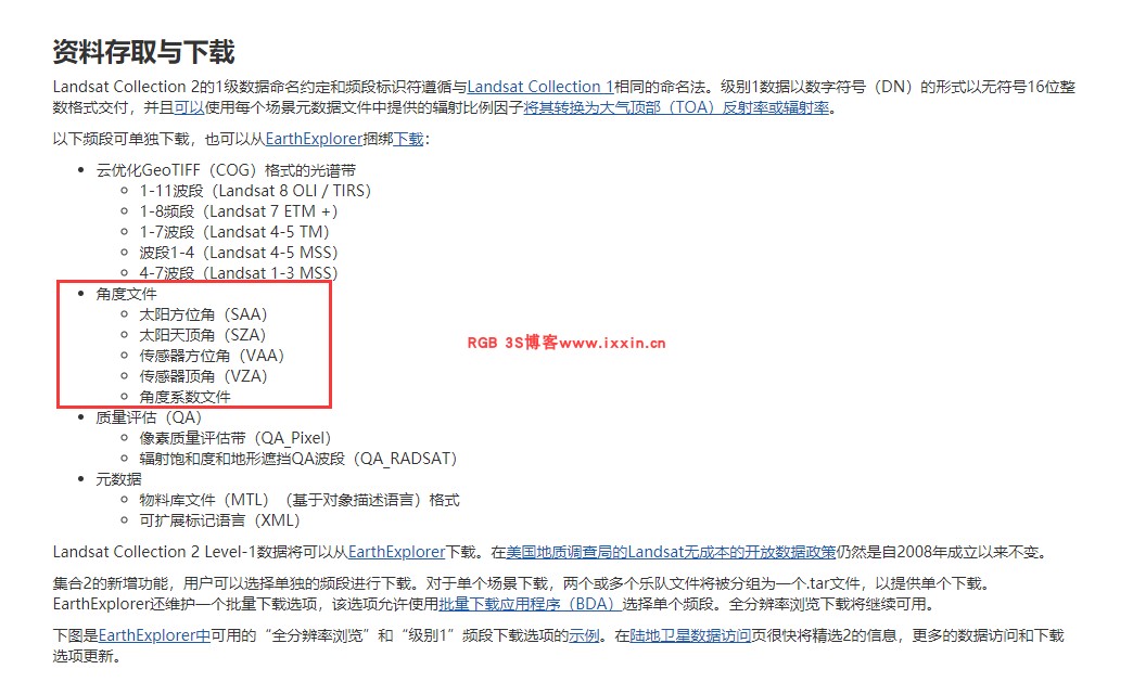
2 数据下载支持角度文件
逐像元的角度数据可以支撑更加精确的定量应用。
L2更新关注点:
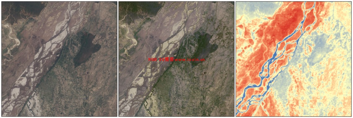
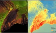
左:Landsat Level-1表观反射率。中心:Landsat Level-2地表反射率。右:Landsat Level-2地表温度。数据于2013年5月3日获得(140, 41)。
Collection1 (C1) 和 Collection2 (C2) 对比总结
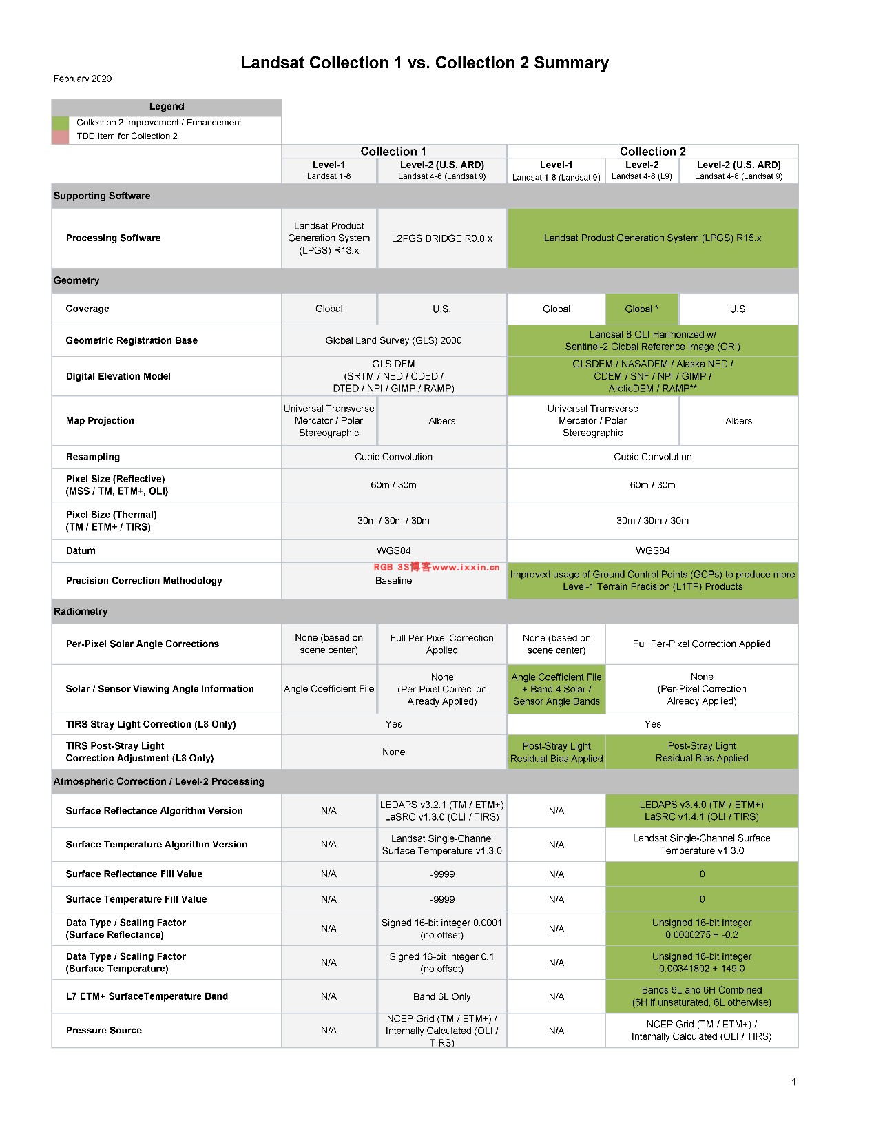
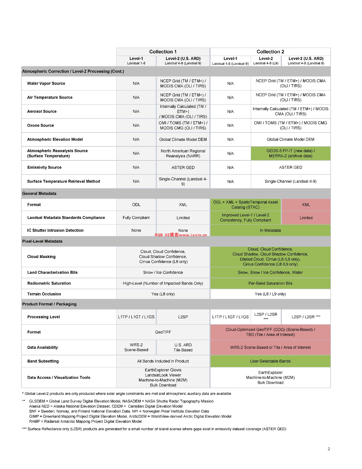
对比关键点:
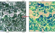
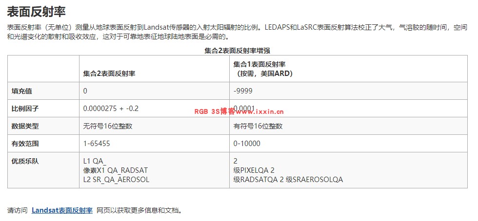
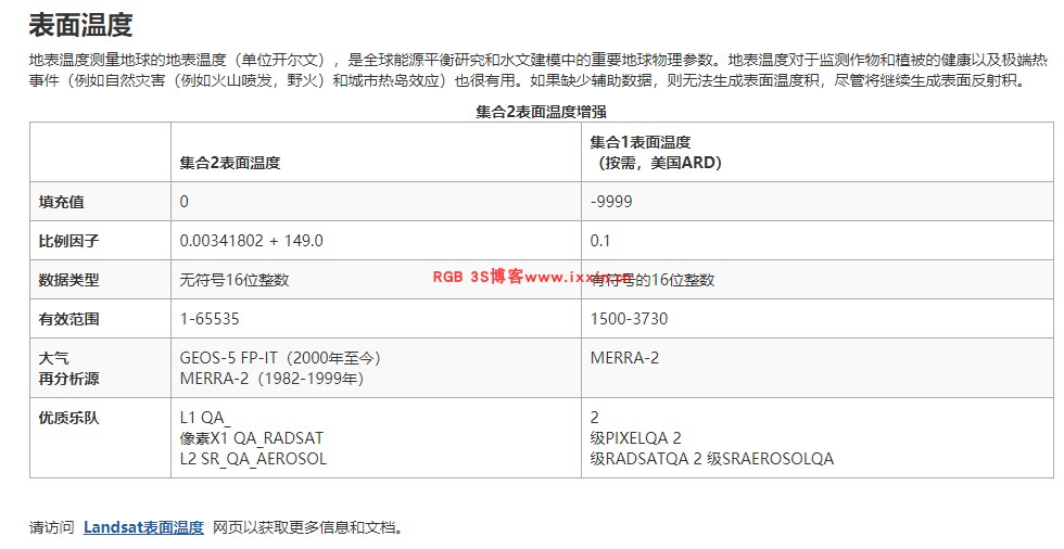
1 C2要处理全球的L2级别产品,包括地表反射率和地表温度。而C1只处理美国区域。
2 与上面提到的一样,提供角度数据
3 大气校正算法的更新(LEDAPS十几年的项目还在更新。。。)
4 LC8大气校正程序,LaSRC 使用的气溶胶参数是MODIS数据。