前言
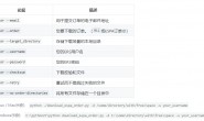
一个很有意思的模块”geocoder“,只要功能是地理编码与反地理编码,集合了国内外很多地图。

演示
本次演示,IDE为ipython,api为Arcgis,因为他不需要Key。
地理编码
In [1]: import <a href="https://www.ixxin.cn/tag/geocoder/" title="查看更多关于geocoder的文章" target="_blank">geocoder</a>

In [2]: g = <a href="https://www.ixxin.cn/tag/geocoder/" title="查看更多关于geocoder的文章" target="_blank">geocoder</a>.arcgis("qingdao")

In [3]: g.wkt
Out[3]: 'POINT(120.371939388 36.098605988)'

In [4]: g.json
Out[4]:
{'address': u'Qingdao, Shandong, China',
 'bbox': {'northeast': [36.209606, 120.482939],
  'southwest': [35.987606, 120.260939]},
 'confidence': 1,
 'encoding': 'utf-8',
 'lat': 36.098605988000486,
 'lng': 120.37193938800056,
 'location': 'qingdao',
 'ok': True,
 'provider': 'arcgis',
 'quality': u'POI',
 'score': 100,
 'status': 'OK',
 'status_code': 200}
反地理编码
In [14]:  g = <a href="https://www.ixxin.cn/tag/geocoder/" title="查看更多关于geocoder的文章" target="_blank">geocoder</a>.arcgis([45.15,-75.14],method = "reverse")

In [15]: g.city
Out[15]: u'North Stormont'

In [16]: g.country
Out[16]: u'CAN'
IP地址
In [17]: g = geocoder.ip('199.7.157.0')

In [18]: g.city
Out[18]: u'Scarborough'

In [19]: g = geocoder.ip('me')

In [20]: g.city
Out[20]: u'Jinan
距离量算
In [26]: d = distance("Ottawa, ON", "Toronto, ON")

In [27]: print d
352.669845047

In [28]: d = distance("Ottawa, ON", "Toronto, ON",provider = "google")

In [29]: print d
352.669845047

In [30]: d = distance("Ottawa, ON", "Toronto, ON",provider = "arcgis")

In [31]: print d
352.669845047

In [32]:  d = distance("Ottawa, ON", "Toronto, ON",provider = "arcgis",units = "miles")

In [33]: print d
219.138814287


值得注意的是,默认地图为必应,默认单位不是米,中国的城市不能量测,如下:
In [25]: dis = distance("qingdao,ON","jinan,ON",provider = "google")
[WARNING] Error calculating the following two locations.
Points: qingdao,ON to jinan,ON
后语
作者GitHub地址:https://github.com/DenisCarriere/geocoder,可以去给他点星星。